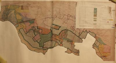
Planning map for South Bucks joint planning committee for the area of Dorney and Eton Wick.
One of a large collection of maps on loan from the Environment Agency, and originally collected by them for engineering and maintenance purposes.
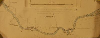
Ordnance Survey map of part of Surrey, showing part of the River Mole. The river course is marked at points and probably used for land drainage and defence planning. Dated c1935.
Coloured map, 1938, for the South Buckinghamshire Joint Planning Committe. The map shows Thames flood levels for 1894, 1915, and 1933 for the Thames between Romney Lock and Boveney Lock
Coloured map, 1938, for the South Buckinghamshire Joint Planning Committe. The map shows the Thames at Old Windsor, with a table showing the flood levels for 1894, 1915, 1933
Thames Conservancy River Purification Department - River Thames Above Teddington and London Excluded Area Map.
Scale 1/250,000. Printed by Cook Hammond & Kell Ltd.