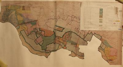
Planning map for South Bucks joint planning committee for the area of Dorney and Eton Wick. One of a large collection of maps on loan from the Environment Agency, and originally collected by them for engineering and maintenance purposes.
Map of the River Thames mounted in a wooden frame, showing Richmond to Reading.
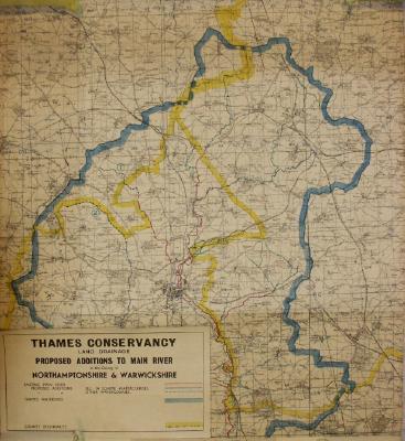
A Thames Conservancy map detailing land drainage in Northants and Warwickshire.
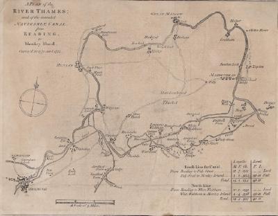
A map of the Thames and the proposed navigable canal from Reading to Monkey Island. Surveyed in 1770 and 1771.
A site plan for a building extension at Egham.
A sketched map of the area near to the Thames Conservancy riverside works at Sunbury.
Map showing part of the course of the River Thames from Rushey Lock downstream to a point a short distance above Shifford Lock.
An ordnance survey map of part of North Oxfordshire.
Map showing part of the course of the River Thames and follows on from map 220.51.7.3. There are no major features.
Map showing sites in the Henley area mentioned in the Domesday Survey of 1086.