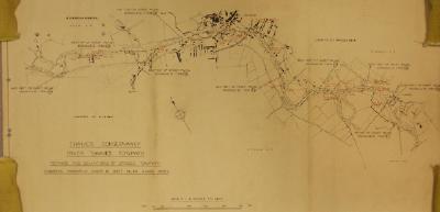
A Thames Conservancy towpath map for Magna Carta Island to Laleham, showing bridges and gates. Scale 6"=1 mile
A Thames Conservancy towpath map for Days Lock to Benson, showing bridges and gates. Scale 6"=1 mile
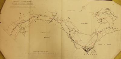
A Thames Conservancy towpath map for Sandford to Culham, showing bridges and gates. Scale 6"=1 mile
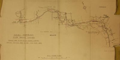
A Thames Conservancy towpath map for Culham to Burcot, showing bridges and gates. Scale 6"=1 mile
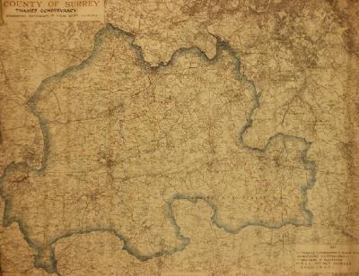
A Thames Conservancy map for the County of Surrey, showing suggested extensions of the River Thames. Dated June 13 1945.
A Thames Conservancy map of the River Thames Survey and Sounding at Grafton Reach Buscot Weir Pool. Scale 1:500. Dated 15th & 16th August 1972
A Thames Water, Thames Conservancy Division Map: River Thames Soundings, Buscot Reach. Dated July 1979.
A map showing the public rights of way claimed along the Thames between Eton and Wraysbury.
A map showing the public rights of way claimed along the Thames between Henley and Hurley. Dated c1949.
A Thames Conservancy Map: River Thames Soundings, Buscot Reach. Dated March 1972.